The History and Future of Lake Okeechobee’s Water Management
Lake Okeechobee is the heart of South Florida’s water system, supporting everything from flood protection and water supply to recreation and wildlife. How we manage “Lake O” directly impacts the health of Florida’s coastal ecosystems, including the St. Lucie Estuary and Indian River Lagoon. Decisions about water levels and discharges shape the future of our waterways, marine life, and communities.
A Look Back: The 2008 Lake Okeechobee Regulation Schedule (LORS 2008)
In 2008, the U.S. Army Corps of Engineers (USACE) adopted a plan called the Lake Okeechobee Regulation Schedule 2008 (LORS-2008). This plan guided how and when water was released from the lake.
Under LORS 2008:
-
The lake was managed using “bands” based on its depth — such as the Base Flow Band (around 12.5–15.5 feet) and the High Lake Band (above 16 feet).
-
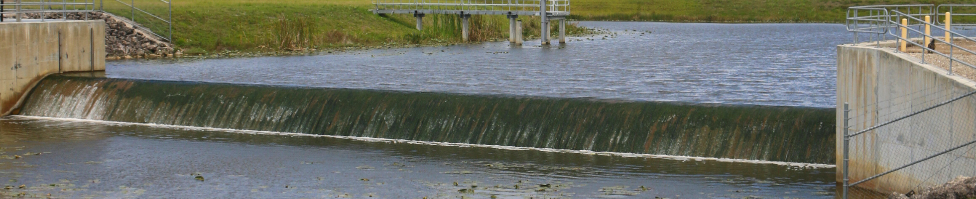
When lake levels rose too high, freshwater discharges were sent east to the St. Lucie Estuary and west to the Caloosahatchee Estuary to lower the water level.
-
These discharges often carried nutrient-rich water, which disrupted salinity, fueled harmful algal blooms, and hurt oysters, seagrass, and other marine life.
To learn more about these ecosystems, visit our pages on the St. Lucie Estuary and Indian River Lagoon and Florida’s Coastal Ecosystems.
A New Chapter: The Lake Okeechobee System Operating Manual (LOSOM)
In August 2024, the USACE approved the Lake Okeechobee System Operating Manual (LOSOM), a new and improved plan to replace LORS-2008.
LOSOM takes a system-wide approach to managing water — balancing flood protection, ecosystem health, and water supply across the region. It also takes into account new restoration projects under the Comprehensive Everglades Restoration Plan (CERP) and the repaired Herbert Hoover Dike.
Key improvements under LOSOM include:
-
More flexibility to adapt to real-time conditions.
-
Greater stakeholder engagement and transparency.
-
A focus on benefiting the entire ecosystem, not just managing lake levels.
Learn more about how this connects to the Everglades Restoration.
Why It Matters for the Treasure Coast
When Lake Okeechobee’s water levels are high, discharges flow east through the C-44 Canal, starting at Port Mayaca and reaching the St. Lucie Lock and Dam. These releases send fresh, nutrient-heavy water into the estuary, lowering salinity and stressing marine life.
Low salinity levels can cause oyster and seagrass die-offs, which disrupt the food web and the overall health of the Indian River Lagoon.
At Florida Oceanographic Society, we’re advocating for a future where:
-
More water flows south to the Everglades and Florida Bay—where it belongs.
-
Fewer harmful discharges flow to the St. Lucie and Caloosahatchee estuaries.
-
Water quality and ecosystem health are prioritized alongside flood control.
Our Advocacy Focus for LOSOM 2.0
With the EAA Reservoir now scheduled for completion in 2029 (five years ahead of plan), discussions are already beginning for LOSOM 2.0 — the next evolution of lake management.
Florida Oceanographic Society is advocating for:
-
Stronger water quality protections to reduce nutrient pollution.
-
Transparent, real-time data sharing with the public.
-
Infrastructure investments—like reservoirs and treatment areas—to filter water before it reaches estuaries.
-
Adaptive management that evaluates results and improves decisions over time.
Learn more about our efforts on our Advocacy Page and explore how you can help protect Florida’s waterways.
A Shared Responsibility
At Florida Oceanographic Society, we believe that clean water connects us all. How Lake Okeechobee is managed affects every community — from the Kissimmee River Valley to the St. Lucie Estuary and beyond.
Together, we can create a future where healthy waterways, thriving habitats, and resilient ecosystems define Florida’s legacy.
Learn more about our work in Water Quality and Everglades Restoration.
