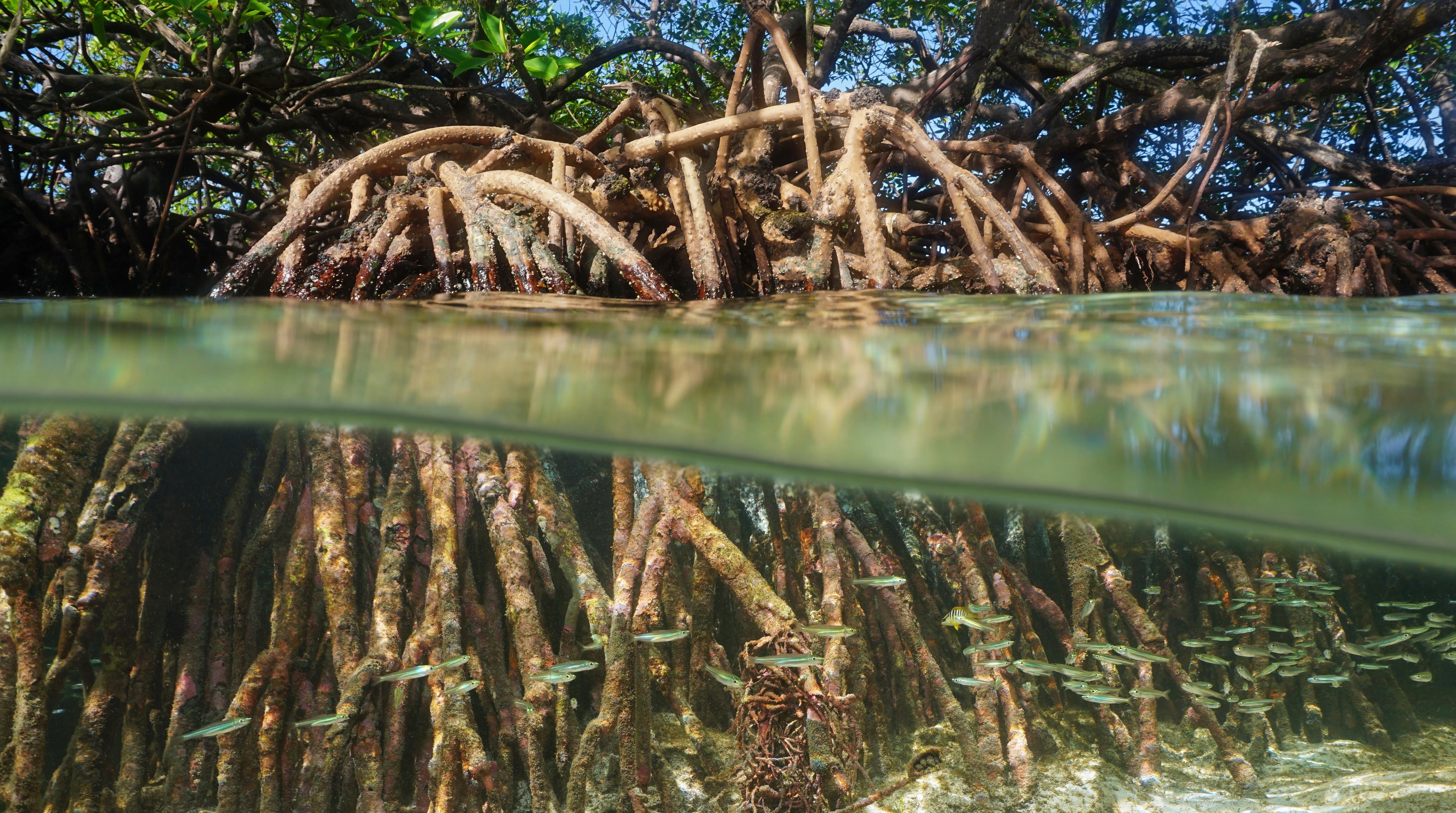
An estuary is a body of water that contains a mix of freshwater and saltwater, usually formed where a river meets a sea.
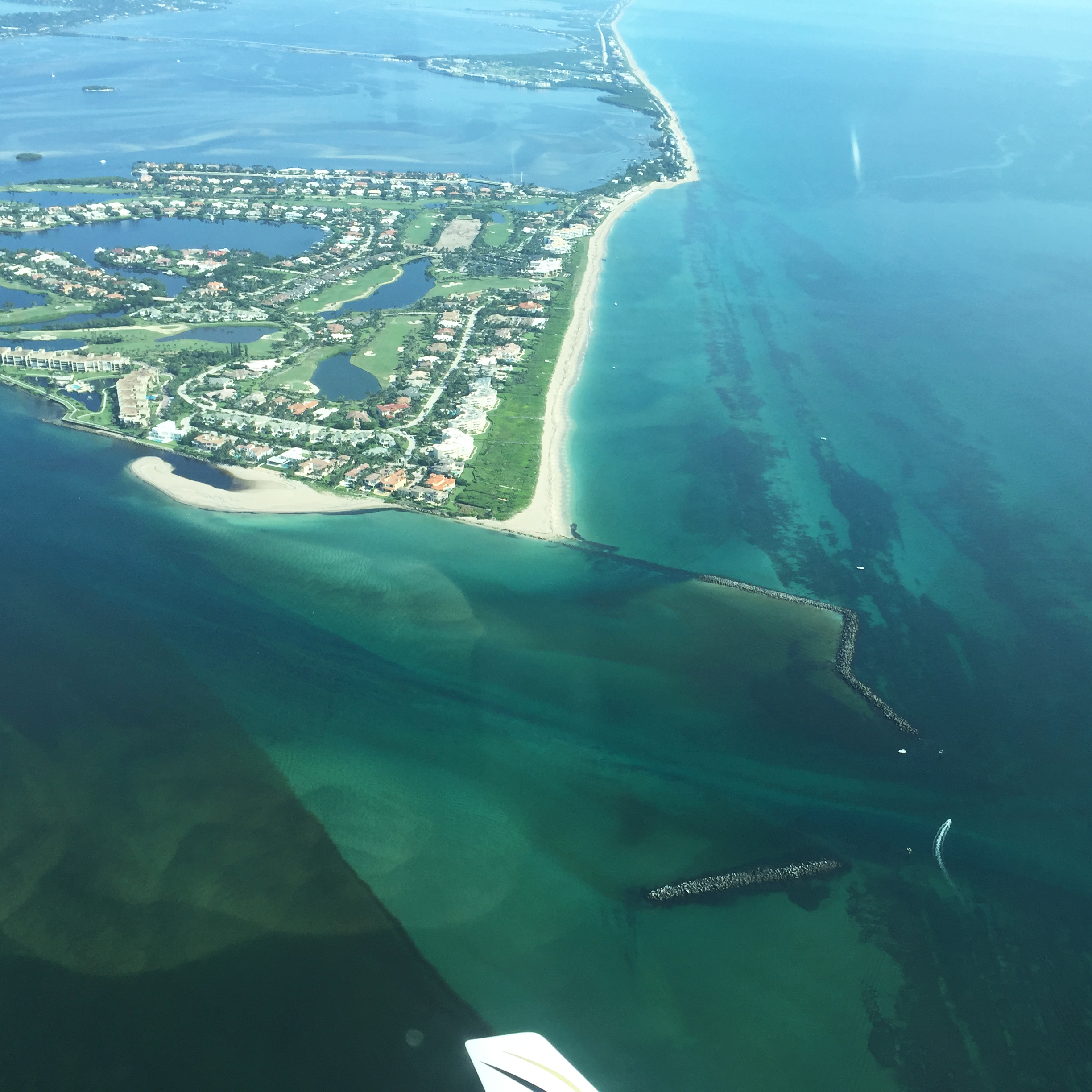
The St. Lucie River and Estuary (SLRE), located along Florida’s southeast coast, is one of the most biologically-diverse estuaries in the nation, and is home to more than three dozen threatened and endangered species. Unfortunately, the SLRE is also one of the most ecologically-stressed river and estuarine systems in Florida.
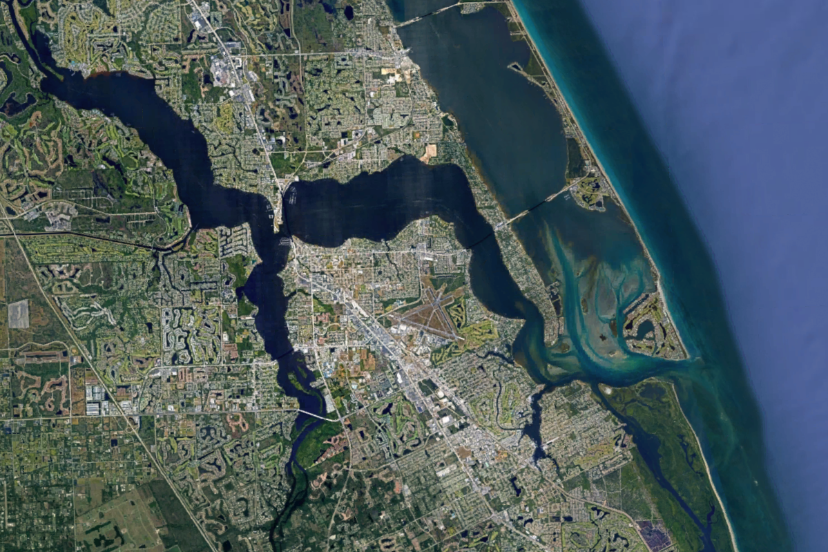
Image from Google Earth
At the turn of the 20th century, the St. Lucie River ran clear and was known as the “Tarpon Fishing Capital of the World," renowned for its inshore tarpon fishing.

Historical drainage of the St. Lucie River Watershed.
The watersheds of the North Fork and South Fork of the River extended a few miles west to a ridge that separated Allapattah Slough, Cane Slough and other areas that flowed north to the St. John’s River or south to the Loxahatchee River. There was no natural connection between Lake Okeechobee and the SLRE.
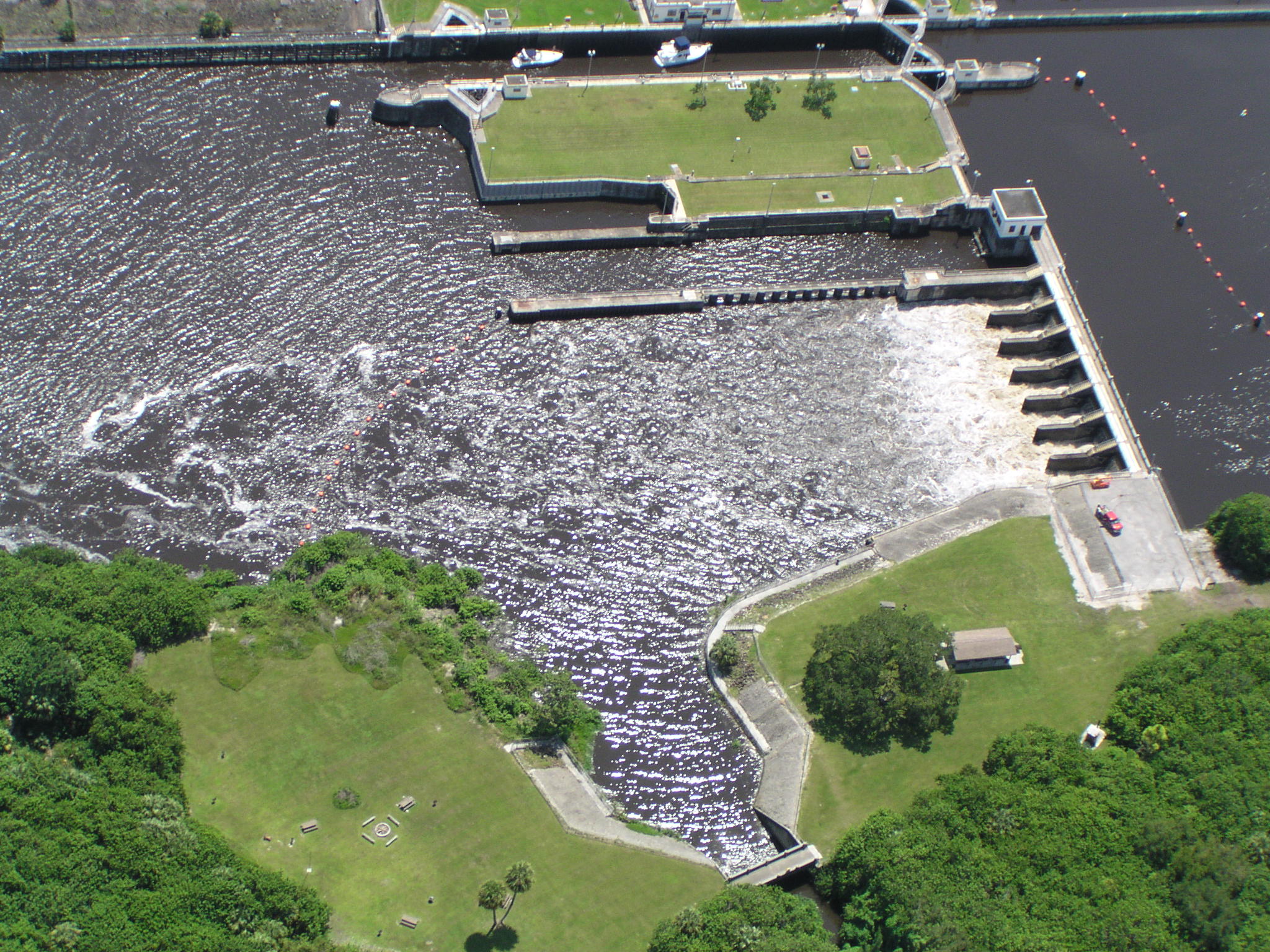
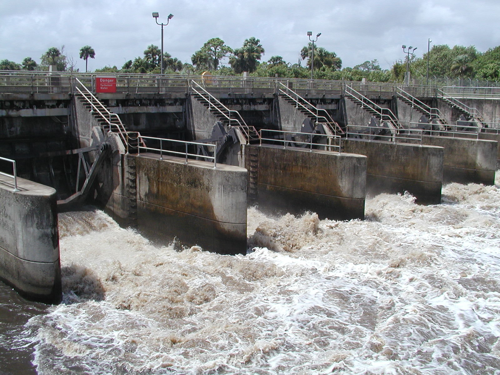
In 1913, the State of Florida decided to construct a canal between Lake Okeechobee and the SLRE to divert overflow water from the lake in order to encourage and enhance agricultural and community development south of the Lake. The first discharge of Lake water into the SLRE is reported to have occurred on June 13, 1923.
Fishing guides, residents and local governments quickly realized the environmental consequences of the Lake releases, and by 1930, Martin County Commissioners forwarded the first of many requests to terminate the discharges. As sediment from the Lake muddied the once-clear river and estuary, the inshore tarpon fishing industry collapsed.
For over 90 years, the region's environmental and economic health has been sacrificed by state and federal agencies through diversion of polluted water from Lake Okeechobee in order to provide flood protection and irrigation benefits to farms and communities south of Lake Okeechobee.
The spatial extent of the SLRE watershed has more than doubled in the last century as major agricultural canals were constructed. These canals now contribute significant loadings of nutrient and unknown quantities of pesticides. The dominant land uses in the watershed are agriculture (55%), natural areas (26%), urban areas and other (19%).
Lake Okeechobee is a shallow freshwater lake in south Florida that covers over 730 square miles. It is the central component of the Greater Everglades Ecosystem that stretches from the upper Kissimmee River Chain of Lakes and south through the Everglades to Florida Bay. It is often referred to as the liquid heart of Florida.
Image from Martin County Florida
In the late 1800s and early 1900s, settlers desired to drain the vast acreage of swampland to farm, build and live in the untamed ecosystem. Lake Okeechobee received the inflow from the Kissimmee River and numerous smaller rivers along its border and routinely overflowed to the south, forming the headwaters of the expansive Everglades sawgrass and tree island ecosystem. Imagining the economic profit available by farming what was the historic sawgrass marsh to the south of the lake, early state leaders began implementing schemes designed to drain this area and to divert the overflow from the Lake to the Ocean and Gulf.
As early as the 1880s, the state supported dredging the Caloosahatchee River to move more lake water to the Gulf. By 1915, the state began dredging the St Lucie Canal to convey lake water to the Atlantic Ocean. The first discharges of Lake water to the St Lucie Estuary occurred in 1923.
Following devastating hurricanes in 1926 and 1928 that killed thousands of people around the lake, the state of Florida asked the US Army Corps of Engineers to replace a sand and muck dike along the southern shore of the lake with a more effective flood protection system. The result was the Herbert Hoover Dike that encircles the Lake, severely curtailing the once-plentiful flow of nourishing lake water to the Everglades and Florida Bay. Later on, the Corps would supplement the dike with a comprehensive system of canals, levees and water control structures that moves water off the land to enable agricultural and urban development.
By 1930, Martin County was pleading for the state to stop the discharges. Much like today, state leaders prioritized lake operations for the benefit of agricultural interests south of the lake over the public health, economy and environment of the estuary regions.
Throughout the remainder of the 20th century, state and federal changes made around the Lake increased the rate and volume of inflow to the lake to encourage agricultural and urban development. The natural sheet flow that slowly brought water south through the Everglades and into the Gulf and Florida Bay was virtually cut-off. Mother Nature’s way of moving water across the land was replaced by water control structures under the management of the U.S. Army Corps of Engineers and its local sponsor, the Central and Southern Florida Flood Control District – now the South Florida Water Management District, a public agency created by the state of Florida.
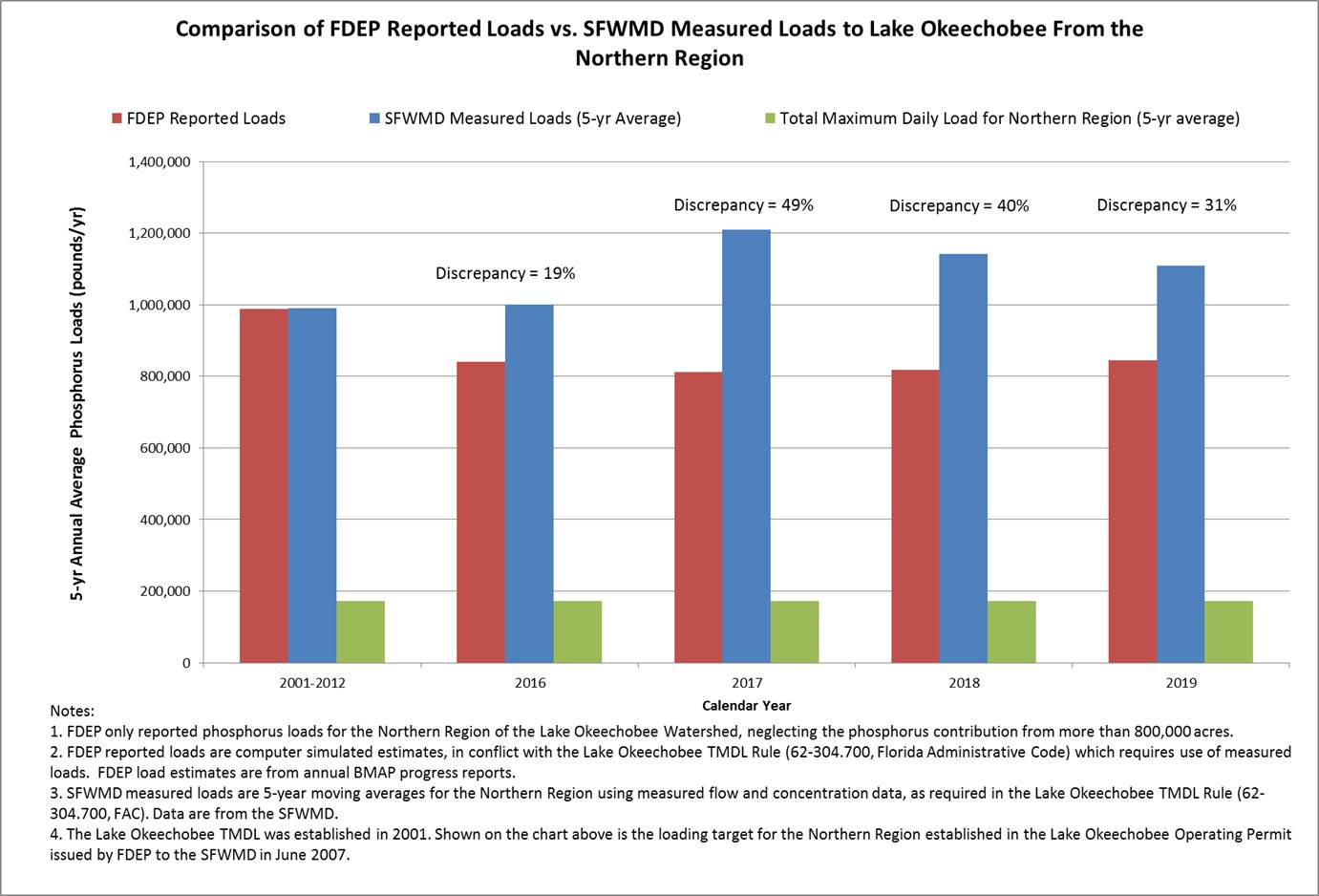
The figure below shows the discrepancy between the phosphorus load to Lake Okeechobee that the FDEP reports (estimates) compared to the measured phosphorus load shown in District data.
Estuaries Are THREATENED BY Lake Okeechobee Discharges and Human FActors which cause:
Why is this a problem?
There is an overstimulate growth of harmful algae.
How can the problem be fixed?
Better management of sources, which include Lake Okeechobee discharges, agricultural runoff, septic tanks, and urban runoff.
Learn more!
As agricultural and urban development increased in the Lake Okeechobee watershed, the water entering and within Lake Okeechobee has become more and more polluted, primarily from agricultural activities.
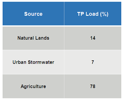
The state estimates that more than 75% of phosphorus entering the Lake comes from agricultural land uses. For more than 4 decades state and federal agencies have implemented activities designed to reduce the pollution entering the lake, including conducted research, monitored water flow and water quality, established regulatory (i.e., permitting) programs, constructed regional storage and treatment systems, offered extensive dairy buyouts, and assisted agricultural landowners with best management practices (BMPs). However, the state continues to allow landowners to discharge high levels of nutrients with little to no enforcement, and the pollution of Lake Okeechobee and the estuaries continues. The water quality of the lake is at an all-time crisis level, and human health is suffering as polluted lake water is discharged to the estuaries. For calendar year 2017 the 5-yr average phosphorus loading to the lake was more than 5 times the pollution limit established for the watershed; this pollution target is called the “Total Maximum Daily Load” or “TMDL.” The result: an algae bloom covered 90 percent of the lake during the summer of 2018 (NOAA 2018). In addition, the state’s annual “progress report” on efforts to reduce pollution of the lake underestimates the actual loading to the lake. For the last two years the state has published reports indicating phosphorus loading to the lake has decreased – yet these claims conflict with the measured loads to the lake, e.g., the average load measured in 2017 was almost 50% higher than reported by state.
To protect the agricultural and urban communities south of the lake, polluted lake water is sent to the St. Lucie and Caloosahatchee Estuaries causing significant public health, economic, and environmental harm these damaging lake discharges contain excessive phosphorus, nitrogen, suspended sediment, and at times, toxic blue green algae. While discharges to the St Lucie vary year to year, the average annual magnitude of pollution carried by these discharges over the last 10 years include
- Over a million pounds of total nitrogen
- Over 110 thousand pounds of total phosphorus
- Over 25 million pounds of total suspended sediment
- Untold million pounds of toxic blue green algae, and
- Over 80 billion gallons of low salinity water that adversely affects the salinity in the river and estuary
The health of people and their pets in the estuarine communities have been adversely impacted by the polluted discharges of Lake Okeechobee that contain toxic blue green algae. The St Lucie region has twice the national average rate of death due to nonalcoholic liver disease, and this is highly correlated to lake discharges.
Lake Okeechobee isn’t the only source of pollution to the estuary (see pie charts below). Our local watershed also contains excessive nutrient loads from agricultural and other land uses. Despite establishing Total Maximum Daily Loads of phosphorus and nitrogen, the state has not established an effective pollution control program in the watershed.

Why is this a problem?
Sediment smothers and kills benthic organisms and seagrass and holds a toxic 'soup' of algae, nutrients, and pesticides that can be re-suspended during subsequent Lake or stormwater discharge events.
How can the problem be fixed?
Better management of sources, which include Lake Okeechobee discharges and agricultural runoff.
Learn more!
The largest single source of total nitrogen, total phosphorus and sediment load to the SLRE was Lake Okeechobee discharges, which total more than 100 billion gallons in Water Year 2019. In addition, total phosphorus concentrations in Lake Okeechobee discharges to the SLRE remained more than 5 times the lake’s Total Maximum Daily Load (TMDL) in-lake target concentration of 40 parts per billion (ppb). The South Florida Water Management District (SFWMD) reported that the 5-yr average annual phosphorus loading to the lake from surrounding watersheds was almost 5 times the Lake’s TMDL of 105 metric tons, yet staff acknowledged the agency does not enforce permits that set numeric limits on phosphorus discharges to the lake. Unfortunately, despite the continued and well-publicized pollution of the lake, the Florida legislature in 2016 enacted a water bill that pushed back deadlines for achieving the lake’s TMDL by decades (Ch. 2016-1).
Another pollutant which has significantly affected the water quality of the SLRE is sediment, which is carried into the River from Lake discharges and runoff from agricultural and other land uses. On average, more than 28 million pounds of sediment enters the River, with the vast majority (over 80%) from Lake Okeechobee discharges. This sediment has turned the once clear waters and sandy bottom of the estuary into dark and turbid waters overlying an oozy muck layer. This muck is resuspended as the tides ebb and flow, and has smothered oyster beds and once prolific seagrass beds. Dark plumes of sediment laden water are commonly seen spewing from the St Lucie Inlet and extending miles along the shoreline, adversely impacting our near shore reefs.
Why is this a problem?
Too much freshwater damages organisms that rely on saltwater.
How can the problem be fixed?
Better management of sources, which include Lake Okeechobee discharges and agricultural runoff.
Learn more!
The image below shows the current watershed flow. The runoff from the C-25 Basin generally flows east to the Indian River Lagoon, but at times may be directed south into the C-24 Basin. The Tidal Basins include areas downstream of water control structures and includes the South Fork, Basin 4-5-6, North and South Mid-Estuary, and the North Fork Basin, excluding the Ten Mile Creek Basin. The South Coastal Basin does not contribute to the St. Lucie River and Estuary, but rather, to the St. Lucie Inlet area.
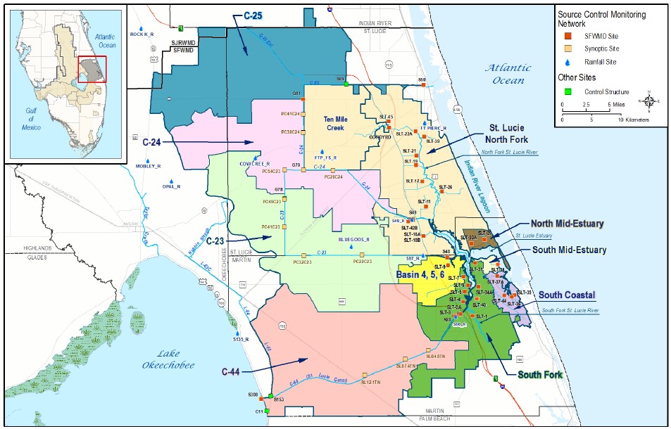
St. Lucie River Watershed, showing locations of sampling sites
Charts showing relative contribution of flow and pollution to the St. Lucie Estuary
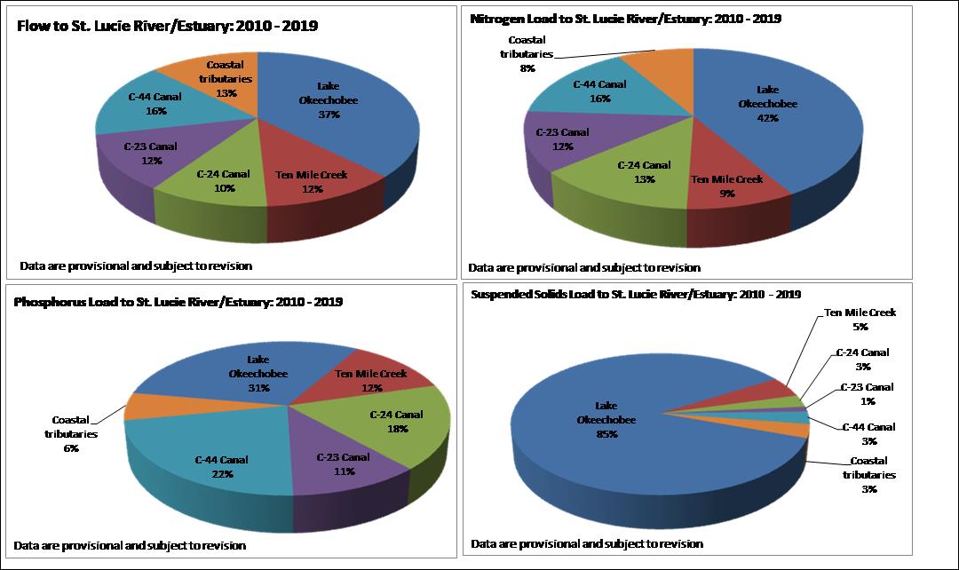
Average annual flow to SLRE = 809,787 acre feet per yr (AF/yr) [264 billion gallons/yr]
Average annual nitrogen load = 3 million pounds/yr [1,500 tons/yr]
Average annual phosphorus load = 539,000 pounds/yr [269 tons/yr]; Ave. ann. sediment load = 33.7 million pounds/yr [16,800 tons/yr]
Why is this a problem?
Algae from Lake Okeechobee and watershed is entering the estuary and lagoon.
How can the problem be fixed?
Better management of sources, which include Lake Okeechobee discharges and agricultural runoff.
Harmful Blue Green Algae
Florida has a public health crisis stemming from the infestation of its freshwater and estuaries by cyanobacteria and other Harmful Algal Blooms. While cyanobacteria (commonly called blue-green algae) are part of the basic web supporting aquatic life in freshwater, an excessive growth of these bacteria can create Harmful Algal Blooms (HABs) that produce cyanotoxins. HABs cause damage to freshwater ecosystems, harm wildlife, livestock and pets, threaten drinking water supplies and the public health. Outbreaks of HABs occur most often when there are high levels of nutrients (the eutrophication of the water), especially nitrogen and phosphorus, in warm and still waters like estuaries, lakes, ponds and reservoirs. Major sources of nutrients include, but are not limited to, agricultural operations, wastewater treatment plants, onsite sewage disposal systems and urban stormwater runoff. Within the St Lucie Estuary, Harmful Algal Blooms only occur with massive discharges from Lake Okeechobee that occur during the warm summer months. These blooms have been documented to form in the lake, and then are transported through the St Lucie Canal into the Estuary.
Various species of algae that produce many different toxins are included in the general grouping of Harmful Algal Blooms, including cyanobacteria and dinoflagellates, which are responsible for Florida red tide.
Learn more!
Click HERE to watch "Seeing Red From So Much Green: The Story of Florida's Algae Issues" webinar presented by Dr. Zack Jud
The FL.O.O.R. (Florida Oceanographic Oyster Restoration) program actively engages the public in restoring oyster reef habitat.
Click Here to learn more about FL.O.O.R.
FOSTER's (Florida Oceanographic Seagrass Training, Education and Restoration) goal is to restore seagrass populations impacted by fresh-water discharges and algal blooms in our estuary.
Click Here to learn more about FOSTER
Support Florida Oceanographic in our mission to inspire environmental stewardship of Florida’s coastal ecosystems through education, research and advocacy.
Click Here to Donate Today!
Florida Oceanographic Society is a 501(c)3. FLORIDA REGISTRATION #: CH32319. A COPY OF THE OFFICIAL REGISTRATION AND FINANCIAL INFORMATION MAY BE OBTAINED FROM THE DIVISION OF CONSUMER SERVICES BY CALLING TOLL-FREE (800-435-7352) WITHIN THE STATE. REGISTRATION DOES NOT IMPLY ENDORSEMENT, APPROVAL, OR RECOMMENDATION BY THE STATE.
